Product: Micro-Magic Inc’s MEMS GNSS/INS, including the I3500 model for mapping applications.
Features:
Advantages: Cost-effective, low power consumption, flexible placement, ideal for various applications like UAVs and aircraft, enhancing navigation precision through the fusion of INS and GNSS data.
Compared to other INS solutions, a MEMS GNSS/INS has a lower size, weight, power consumption and cost. MEMS-based INS are suitable for most applications, including but not limited to: Marine Surveying, Land Surveying, UGVs, Helicopters, Antenna Targeting, Surveying, Robotics, UAVs. This article highlights five key benefits of using MEMS GNSS/INS.
MINS/GNSS integrated navigation, refers to the fusion of information from both MINS (MEMS INS) and GNSS (Global Navigation Satellite System). This integration combines the strengths of both systems to complement each other and achieve accurate PVA (Position, Velocity, Attitude) results.
The advantages and disadvantages of INS and GNSS are complementary. Therefore, combining the two technologies leverages their strengths to provide continuous, high-bandwidth, long-term, and short-term precise, comprehensive navigation parameters. In INS/GNSS or GNSS/INS integrated navigation systems, GNSS measurements suppress the drift of inertial navigation, while INS smooths the GNSS navigation results and compensates for signal interruptions.

The manufacturing processes for MEMS devices are highly cost-effective due to mass production techniques used in the semiconductor industry. This results in lower production costs, making MEMS INS more affordable for a wide range of aviation applications. A MEMS GNSS/INS is not as costly as a FOG-based (fibre optic gyroscope) INS
By nature, MEMS are built on a miniature scale and measure in micrometres. This makes a MEMS-based INS an ideal fit for vehicles or machines that need a small payload.
Take aviation for example, the compact size of MEMS GNSS/INS devices makes them ideal for use in aircraft where space is at a premium. This allows for easier integration into existing systems and more flexibility in aircraft design, potentially freeing up space for additional equipment or cargo. The lightweight nature of MEMS INS contributes to overall weight reduction in aircraft, which is crucial for enhancing fuel efficiency and performance. Lighter navigation systems allow for better payload capacity and improved aircraft range.
The more compact nature of MEMS technology also allows the INS to be mounted in variable positions. The compact and efficient nature of MEMS INS makes them suitable for integration with advanced electronics and automation systems. This adaptability supports the development of more sophisticated management systems and enhances the overall functionality of modern aircraft.

MEMS technology has advanced to the point where it can reduce power used, utilising power cycling and low power modes. MEMS GNSS/INS devices are designed to consume less power compared to traditional INS solutions. This reduced power consumption is beneficial for the electrical system, leading to lower operational costs and increased energy efficiency. For battery-powered applications, such as unmanned aerial vehicles (UAVs) or smaller aircraft, the lower power consumption of MEMS INS extends mission durations and operational capabilities, enabling longer flights and reducing the need for frequent recharges.
With any kind of inertial navigation system, a MEMS GNSS/INS isn’t able to determine absolute position. By itself, the MEMS INS is able to determine the relative position of the vehicle from a known starting point, accounting for distance travelled and orientation. When a MEMS INS is combined with GNSS (global navigation satellite system) it takes advantage of the satellite technology to accurately determine the absolute position on Earth. With these two navigational technologies working in tandem, the strengths of both enable a high level of accuracy.
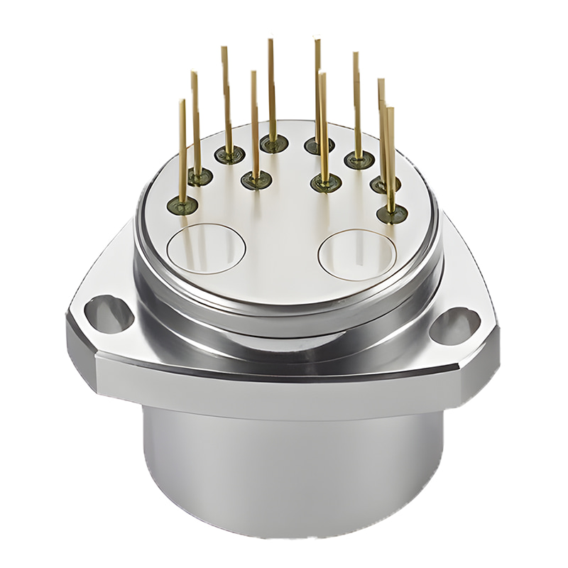
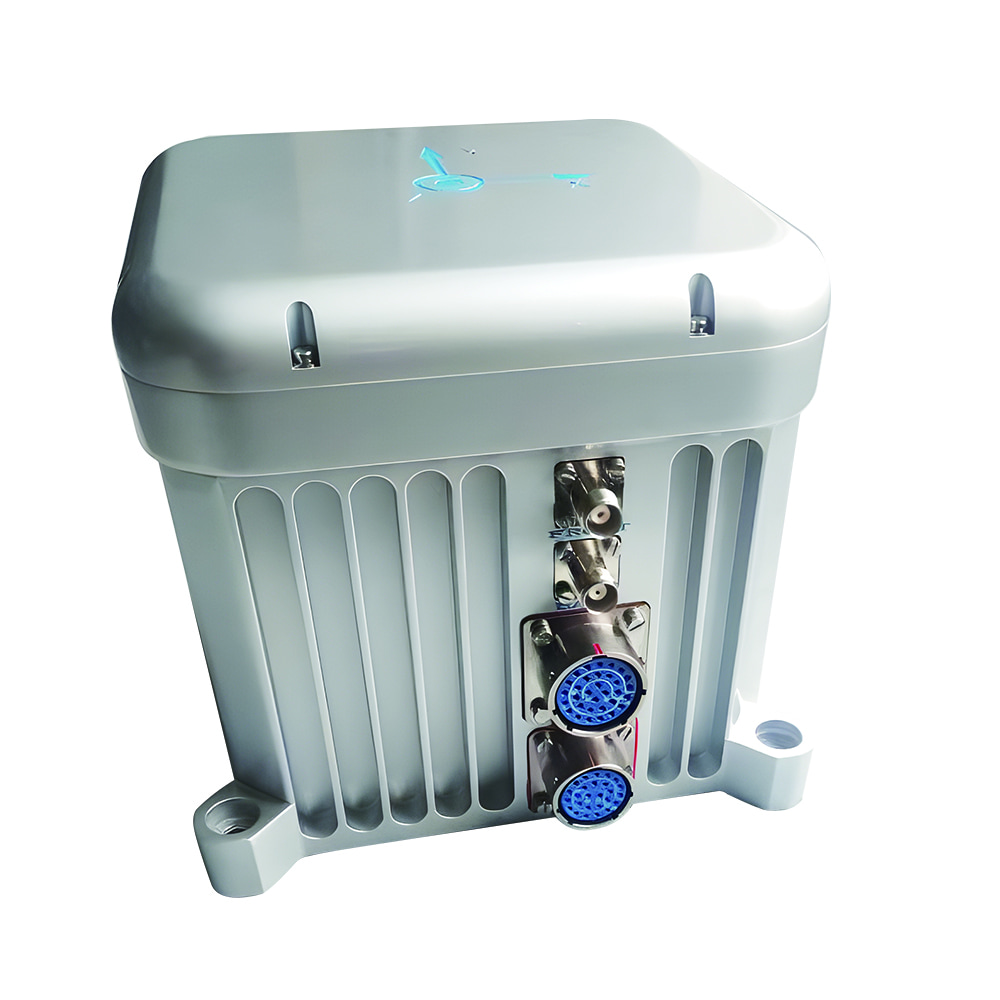
Micro-Magic Inc is at the forefront of inertial navigation technology and has recently introduced three GNSS-aided MEMS INS products with varying levels of accuracy (mapping level, tactical level, and industrial level). Notably, the mapping level MEMS INS I3500 features a 2.5°/hr bias instability and a 0.028°/√hr angular random walk, along with a high-precision MEMS accelerometer with a large range (±6g, zero bias instability <30μg).

More importantly, in an integrated navigation system, the INS leverages its high short-term accuracy to provide GNSS with continuous and comprehensive navigation information. Conversely, GNSS helps estimate INS error parameters, such as bias, resulting in more precise observations and reduced INS drift. GNSS offers stable long-term accuracy, provides initial values for position and speed, and corrects accumulated errors in the MEMS INS through filtering. The ER-GNSS/MINS-01 stands out as an excellent solution.

Xml Privacy Policy Blog Sitemap
copyright @ Micro-Magic Inc All Rights Reserved.
 Network Supported


 English